The Northern Sumatra Earthquake has once again highlighted the intense seismic volatility of the Indonesian archipelago after a significant tremor rattled the region early Sunday morning. Residents across several districts were jolted from their sleep as the ground shook with considerable force. Despite the alarming nature of the vibrations, initial assessments bring a sense of relief to the local population.
Emergency services were deployed immediately following the event to evaluate the status of residential areas and vital lifelines. Local authorities have maintained a steady flow of communication to prevent panic among the coastal communities who are often wary of such events. The resilience of the regional infrastructure is currently being tested as engineers conduct thorough inspections of bridges and power grids.
Technical Data from GFZ Research Centre
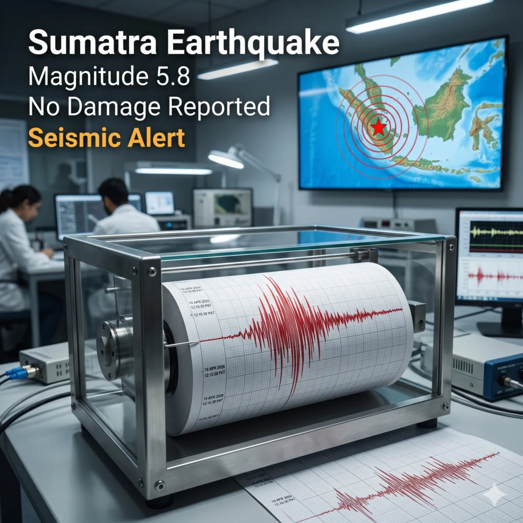
The Northern Sumatra Earthquake was meticulously tracked by the GFZ German Research Centre for Geosciences to provide accurate data for global monitors. According to their official readings, the seismic event occurred at approximately 3:06 am local time, catching most of the population in their homes. Technical instruments pinpointed the epicenter at 1.29 degrees north latitude and 97.21 degrees east longitude.
Seismologists noted that the quake struck at a remarkably shallow depth of only 10 kilometers below the earth’s crust. Shallow earthquakes are often felt more intensely at the surface compared to deeper events of the same magnitude. This proximity to the surface explains why the vibrations were reported so vividly by residents living many kilometers away from the primary epicenter.
Northern Sumatra Earthquake
The occurrence of the Northern Sumatra Earthquake serves as a stark reminder of the geographic challenges faced by those living on the Ring of Fire. This specific tectonic event reached a magnitude of 5.8, which is categorized as a moderate to strong earthquake capable of causing structural issues. However, the lack of immediate reports regarding collapsed buildings suggests that local construction standards may be improving.
Experts are continuing to analyze the aftershock patterns following the Northern Sumatra Earthquake to predict any further activity in the coming days. While the primary shock has passed, the risk of smaller tremors remains a concern for disaster management agencies in the province. Maintaining public awareness and readiness is the primary focus for the Indonesian government during this sensitive post-quake period.
No Tsunami Threat Issued Following Tremor
One of the most critical updates following the Northern Sumatra Earthquake was the confirmation that no tsunami warnings were necessary for the region. Because the quake did not displace a sufficient volume of water, coastal residents were spared from the threat of rising sea levels. This news provided significant mental relief to those living in areas previously affected by historical maritime disasters.
Disaster management officials utilized social media and local radio broadcasts to disseminate this information rapidly to avoid unnecessary evacuations. The absence of a tsunami threat allowed emergency teams to focus entirely on land-based inspections and humanitarian check-ins. Coastal surveillance remains active as a standard protocol, but the immediate danger from the ocean has been officially ruled out.
Infrastructure Resilience and Damage Reports
Following the Northern Sumatra Earthquake, the provincial government initiated a rapid response protocol to check critical infrastructure. Reports from the field indicate that major roads, hospitals, and communication towers remain fully functional without significant cracks or failures. This level of durability is essential for ensuring that emergency services can move freely if subsequent tremors occur.
- No reports of major structural collapses in urban centers.
- Power grids remained stable throughout the pre-dawn shaking.
- Local water supplies have not been contaminated by soil displacement.
- Hospitals reported no surge in earthquake-related injuries or trauma.
Impact on the Local Population
The psychological impact of the Northern Sumatra Earthquake is often more profound than the physical damage in the immediate aftermath. Thousands of residents reported a “strong jolting sensation” that lasted for several seconds, leading many to seek safety under sturdy furniture. Such experiences reinforce the necessity of regular earthquake drills and community education programs across the Northern Sumatra districts.
Local schools and community centers are being used as information hubs where citizens can report minor cracks in their homes. While no fatalities have been recorded, the stress of living in a high-activity zone is a constant reality for these communities. Mental health support and community outreach remain vital components of the regional recovery plan following any significant seismic movement.
Seismologists Analyze Tectonic Plate Movement
The Northern Sumatra Earthquake is a direct result of the complex interaction between the Indo-Australian and Eurasian tectonic plates. These plates are constantly grinding against one another, building up massive amounts of energy that eventually release in the form of seismic waves. Seismologists at the GFZ Research Centre are studying this 5.8 magnitude event to better understand the stress distribution along the fault lines.
By mapping the exact coordinates of the slip, scientists can update their models for future risk assessments in the Indonesian archipelago. This data is shared internationally to help refine global earthquake early warning systems and improve predictive capabilities. Every event of this size provides a treasure trove of information for researchers dedicated to saving lives through better scientific understanding.
Monitoring for Aftershocks and Secondary Risks
Authorities remain on high alert for aftershocks that typically follow an event like the Northern Sumatra Earthquake. These secondary tremors can sometimes be strong enough to finish the damage started by the initial quake, particularly in older buildings. Residents have been advised to remain vigilant and keep emergency kits prepared for the next 48 to 72 hours.
Local disaster management agencies are also monitoring the terrain for secondary risks such as landslides or soil liquefaction in hilly areas. Shallow earthquakes can destabilize saturated soil, leading to dangerous mudslides even hours after the ground stops moving. Aerial surveys are being conducted to identify any new fissures or land displacements that could pose a threat to rural villages.
Comparison with Historical Seismic Events
When comparing the Northern Sumatra Earthquake to previous disasters in the region, the 2026 event appears much less destructive. Sumatra has a long history of devastating quakes, making the current magnitude 5.8 tremor seem moderate by comparison. However, the frequency of these events keeps the local population in a state of constant preparedness and structural adaptation.
This specific event did not reach the catastrophic levels of the 2004 or 2005 disasters, which is a testament to the random nature of plate tectonics. Despite the lower intensity, the Northern Sumatra Earthquake is being treated with the same level of analytical rigor by the global scientific community. Understanding why some quakes cause more damage than others is key to building a more resilient future for Indonesia.
Government Response and Public Safety Advice
The Indonesian government has praised the quick reaction of the GFZ and local monitoring stations for their role during the Northern Sumatra Earthquake. Public safety advice has been reissued, emphasizing the “Drop, Cover, and Hold On” technique for future occurrences. Authorities are also encouraging homeowners to secure heavy furniture and appliances to walls to prevent tipping during vibrations.
Financial aid for minor repairs is being discussed by regional leaders to help those whose properties suffered cosmetic damage. The government’s transparency during the Northern Sumatra Earthquake has been noted as a major improvement in disaster communication strategies. Ensuring that the public has access to factual, real-time data is the best defense against the spread of misinformation during a crisis.
Global Support and Scientific Cooperation
The Northern Sumatra Earthquake attracted international attention, with various geological agencies offering their data-sharing capabilities to Indonesia. This global cooperation ensures that the 5.8 magnitude event is documented from multiple perspectives and instruments. Such collaboration is vital for maintaining a comprehensive global seismic network that protects people regardless of national borders.
International NGOs have also been monitoring the situation, though their active intervention has not been required due to the lack of casualties. The Northern Sumatra Earthquake serves as a case study in how a well-prepared region can withstand a significant tremor without losing lives. The lessons learned here will be shared at upcoming international geological conferences to improve global standards for disaster management.
Concluding Thoughts on Regional Stability
As the dust settles after the Northern Sumatra Earthquake, the region is slowly returning to its normal Sunday routine. The quick confirmation of safety for life and limb has allowed businesses and markets to open as scheduled. While the ground may be still for now, the residents of Sumatra remain ever-watchful of the power beneath their feet.
The successful management of the Northern Sumatra Earthquake proves that investment in monitoring technology and public education pays dividends. Though we cannot prevent the movement of tectonic plates, we can certainly minimize their impact on human civilization. For the people of Indonesia, today is a day of gratitude and a renewed commitment to earthquake safety and regional resilience.
For more details & sources visit: Anadolu Agency
Read more about Indonesia news on 360 News Orbit – Indonesia.