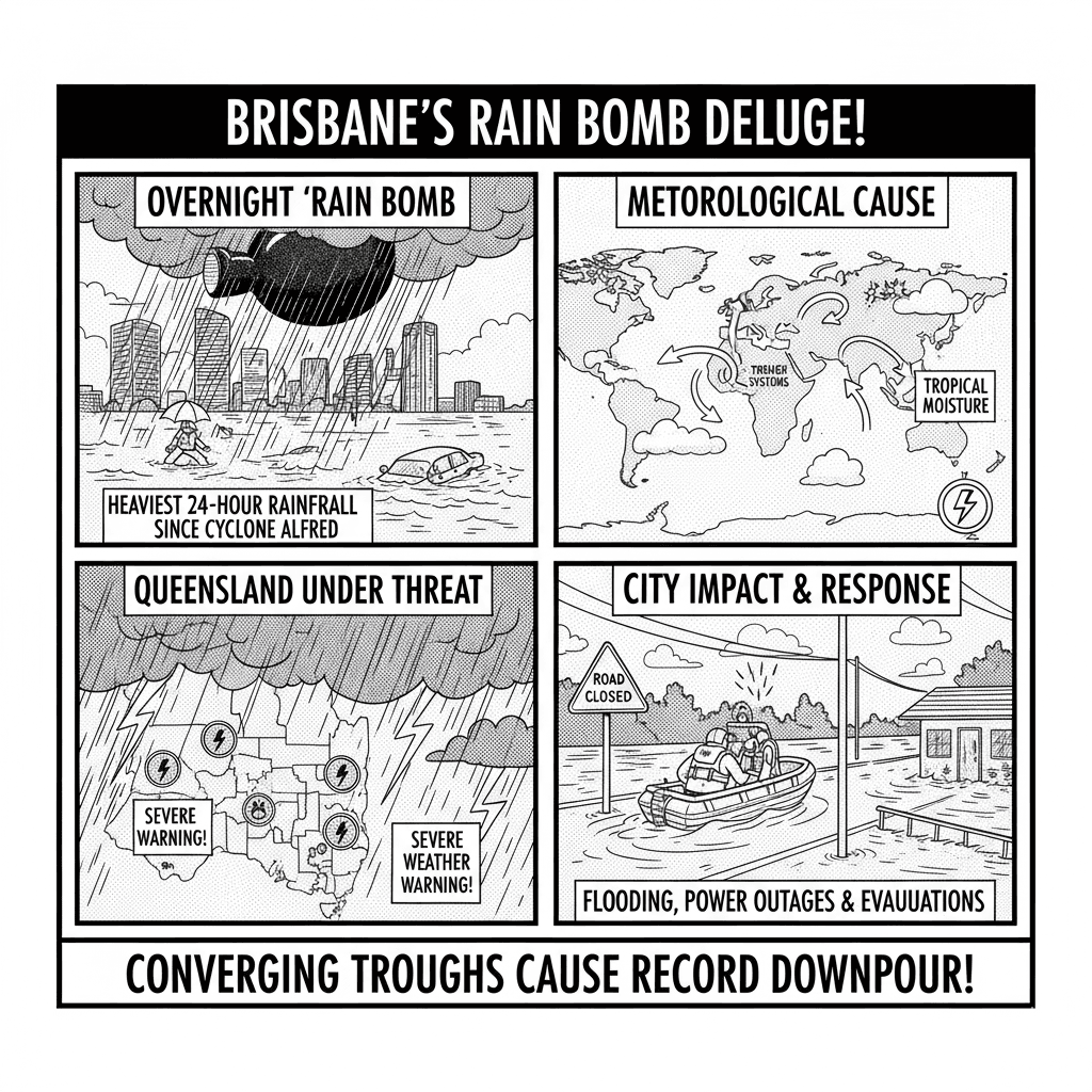
A powerful Brisbane rain bomb drenched the city overnight, delivering its heaviest 24-hour rainfall since Cyclone Alfred. Meteorologists say the sudden downpour was triggered by two converging weather troughs that pulled in deep tropical moisture, creating an intense burst of rainfall.
The deluge has broken several local rainfall records, prompting severe weather warnings across Queensland and raising concerns about flash flooding in nearby regions.
Brisbane Records Heaviest Rainfall in Years
According to Weatherzone, Brisbane Airport recorded 61mm of rain and the central business district (CBD) received 53.8mm by 9 a.m. Wednesday. These were the heaviest October rainfall totals in four to five years and the most significant since Cyclone Alfred’s torrential downpour in March.
Residents woke to flooded streets, waterlogged parks, and disrupted morning commutes, with emergency services responding to multiple calls for assistance.
The Brisbane rain bomb surprised forecasters by its intensity, with rainfall doubling early predictions overnight.
What Caused the Brisbane Rain Bomb
Weatherzone meteorologist Joel Pippard explained that the downpour was caused by “two distinct trough lines” converging over southeast Queensland. Each trough produced roughly 30mm of rain, combining to create the intense Brisbane rain bomb.
The first system — a weak coastal trough — arrived around midday, delivering scattered showers. The second, stronger inland trough pulled humid tropical air from Australia’s Top End, amplifying the rainfall when the systems met over Brisbane.
This convergence of weather patterns produced the city’s wettest 24-hour period in years, demonstrating how multiple trough interactions can rapidly escalate into localized rain events.
Queensland on Alert for More Severe Weather
While skies began to clear over Brisbane on Wednesday afternoon, meteorologists warned that other regions of Queensland remain at risk of severe storms and further heavy rainfall.
The Bureau of Meteorology (BOM) has issued thunderstorm and flash flooding alerts for areas including the Darling Downs, Central Highlands, and Wide Bay regions.
Forecasters caution that the tropical moisture responsible for the Brisbane rain bomb will linger for several days, meaning localized flooding and power outages remain possible across parts of the state.
Historical Context: Comparing to Cyclone Alfred
The Brisbane rain bomb marks the wettest 24-hour period since Cyclone Alfred, which struck Queensland in March 2017, bringing widespread flooding and damage across the state’s north.
Although this week’s event was less severe, meteorologists note the similarity in the atmospheric setup — with warm tropical air colliding with a stalled trough system, creating a sudden and intense rainfall burst.
Experts say such “rain bombs” are becoming more common as climate variability increases the frequency of short-duration, high-intensity weather events.
Authorities Urge Preparedness and Caution
Queensland’s State Emergency Service (SES) has urged residents to stay alert and prepare for potential flash floods, especially in low-lying areas.
Authorities also advised motorists to avoid flooded roads, reminding the public that “if it’s flooded, forget it.”
With saturated ground and continuing instability in the atmosphere, even moderate rainfall could cause new flooding in the coming days.
Source and Reference
Read more on Australia tech news: 360 News Orbit – Australia